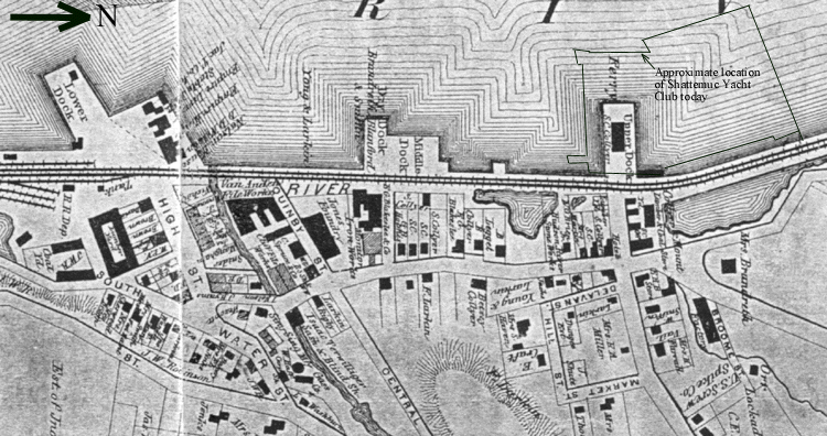
| This portion of DeBeers 1867 map shows the
village of Sing Sing. The Lower Dock (on the left hand side
of the map) was the earliest constructed. Upper Dock lies
to the north (right), and Middle Dock is between. Remnants
of the original shore line are seen inboard of the railroad
embankment. Upper Dock was used as a ship yard, ferry terminal,
and power generating plant. It is now part of Shattemuc
Yacht Club, as marked on the map.
|